Додати об'єкт до каталогу

Надсилайте актуальну інформацію та отримуйте більше цільових клієнтів. Ми розмістимо ваш об’єкт у нашому каталозі та покажемо поруч із локаціями, а також у загальному каталозі, це безкоштовно!

Ski resort Lazeshchyna

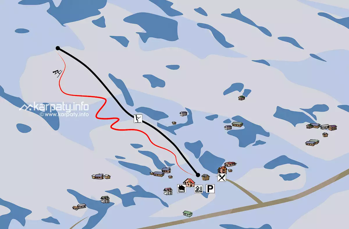
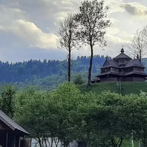
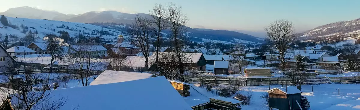
The village of Lazeshchyna in the Rakhiv district of the Transcarpathian region (4816’21.01”N, 2424’52.18”E) is traditionally named as because it was a kind of “crossing” between Galicia and Transcarpathia. Nowadays, Lazeshchyna attracts a large number of tourists in winter who are looking for the best Carpathian resort in terms of price and quality.

In Lazeshchyna, anyone can find an optimal place for rest. Someone is looking for hotel rooms, and someone likes a Hutsul hut. Lazeshchyna, like many other villages in Transcarpathia, is popularly used by skiers and boarders.

Гірськолижний курорт Лазещина

Housing prices in Lazeshchyna are affordable, and the distance to the famous ski resorts in Dragobrat and Bukovel is insignificant. Dragobrat is only 18 km away, and Bukovel – 20 km.

In addition, Lazeshchyna has a convenient regular transport connection. Highway N 09 runs through the village, connecting Mukachevo with Lviv. There is also a railway that regularly runs the “Rakhiv-Lviv” train.

If you don’t have enough resources to go to Dragobrat or Bukovel, you can have fun in Lazeshchyna itself. There is one track 500 m long. The height difference on it is only 80 m. The track here is short and gentle, so Lazeshchyna is a good option for beginners. In addition, the ski resort has a 350 m ski lift.

A brief overview

🗺 Location N48°16’21.01″ E24°24’52.18″
🎿 Number of tracks 1
🏔 Track length 500 meters
⬇⬆ Height difference 80 meters
🟢 Difficulty level Low
⛰ Ratrak Processing No
🧭 Distance from the village. Lazeshchyna Near
🚙 Road for On foot
🏕 Stop with a tent No
🏡 Housing nearby Lazeshchyna
☕ Cafes and shops Lazeshchyna

Temperature in Lazeshchyna now:

-2.5o C   |   27.5o F

On the map

Map of slopes of Lazeshchyna

Карта спусків Лазещини

Map of attractions: Lazeshchyna

Leisure near Lazeshchyna

Етно-парк «Полонина Перці» в Яблуниці
"Polonyna Pertsi" is the most interesting place for a family rest in Yablunytsya. This incredibly picturesque meadow has become a
Гора Хом’як
Mount Khomyak is located at a distance of almost 6 km from the village of Tatariv and is part of
Музей гуцульського побуту у Татарові
This ethnographic museum is located in the village of Tatariv on the territory of the Koruna recreation complex. The museum's
Музей історії та старожитностей Татарова
To get a deeper insight into the history and traditional way of life in Tatariv, it is worth visiting the
Чани Драгобрат
The Dragobrat ski resort is an incredibly popular holiday destination in Ukraine, with excellent natural conditions for skiing as its
Чани на Драгобраті (Ясіня)
The vats in the village of Yasinya are a great choice for relaxation. This is useful for recuperating even after
Історико-краєзнавчий музей (Ясіня)
The Museum of History and Local Lore is located in the north-eastern part of the village of Yasinya near the
Струківська церква у Ясіні
The name of the Strukivska church in the village of Yasinya comes from the surname of Ivan Struk, a shepherd
Скелі Довбуша
The rock and cave complex Dovbush's Rocks is located 7.7 km from the central part of Yaremche, Ivano-Frankivsk region, in
Говерла
Mount Hoverla is located within two Ukrainian regions - Transcarpathia and Ivano-Frankivsk, and it is 17 kilometers from the border
Гора Близниця
The highest mountain in the Svydovets range of the Carpathians is Mount Blyznytsia, which is 1881 metres high. One of
Водоспад Труфанець
Trufanets (Trofanets) is a waterfall in the Ukrainian Carpathians. A hydrological monument of nature of local importance. It is considered
Церква «Введення до храму Пресвятої Богородиці»
The luxurious wooden temple "Introduction to the Temple of the Most Holy Theotokos" of the end of the 20th century,
Озеро Івор
Dragobratske Lake (Ivor) is a high mountain lake of glacial origin in the Ukrainian Carpathians, in the Svidovets massif. It
Озеро Апшинець
Apshynets is a hydrological natural landmark of local importance, a high mountain lake in the Ukrainian Carpathians. It is located
Озеро Герашаська (Догяска)
Gerashaska (another name is Dogyaska, Orati) is a high-altitude lake in the Ukrainian Carpathians, within the Rakhiv District of Transcarpathian
Озеро Ворожеска
Vorozheska (Vorozheske) is a high mountain lake in the Ukrainian Carpathians within the Rakhiv District of the Zakarpattia Oblast. Lake
Природний заповідник Горгани
"Gorgany" is a nature reserve in the Ukrainian Carpathians. It is located in the southwestern part of the Ivano-Frankivsk region,
Водоспад Пробій
Probiy Waterfall is a popular tourist attraction. A 20-meter-high bridge has been built over the waterfall, from which the bravest
Гірський хребет Чорногора
Chornogora is the highest mountain massif of the Ukrainian Carpathians, it includes the town of Hoverla, the highest point in

Excursions to interesting locations in Transcarpathia

Where to stay

Готель «Мисливська вежа»
with. Lazeshchyna, 788, Zakarpattia region.
+380 ....
from 1540₴/night
Садиба «Смерека» у Яблуниці
H09 road, Yablunytsia village
+380 ....
from 512₴/night

Where to eat deliciously

Колиба «Злагода»
986 Tsentralna St., Lazeshchyna village, Zakarpattia region, Ukraine, 90633
+380 ....
Ресторан «Корона Карпат»
St. Tsentralna, 1175, p. Lazeshchyna, Transcarpathian region, Ukraine, 90633
+380 ....

Detailed weather