Додати об'єкт до каталогу

Надсилайте актуальну інформацію та отримуйте більше цільових клієнтів. Ми розмістимо ваш об’єкт у нашому каталозі та покажемо поруч із локаціями, а також у загальному каталозі, це безкоштовно!

Mount Rokyta Velyka

Resting in the village of Mykulychyn, It is worth making time for a trip to the top of the mighty 1111-metre-high Rokyta Velyka mountain.

Rokyta Velyka is located about 10 km from Mykulychyn. The route to the top of this mountain is pleasant and does not present any major difficulties. It is possible to hike to the top of Rokyta Velyka and back during daylight hours. You can do it in one day even in autumn. The return journey takes only 2 hours.

Гора Рокита Велика

Photos and videos of Mount Rokyta Velyka

Brief overview

🗺 Location N48°25′14″ E24°41′58″
⛰ Height 1111 m
🏔 System of the Ukrainian Carpathians Pokutsky-Bukovynsky Carpathians
🧭 Distance from Mykulychyn About 10 km
🚙 Road for Car, bicycle, motorcycle, ATV, on foot
🏕 Stop with a tent Yes
🏡 Housing nearby Mykulychyn
☕ Cafes and shops Mykulychyn

How to get to the top of Mount Rokyta Velyka?

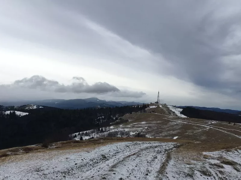
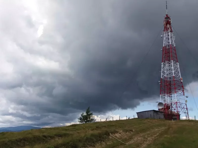
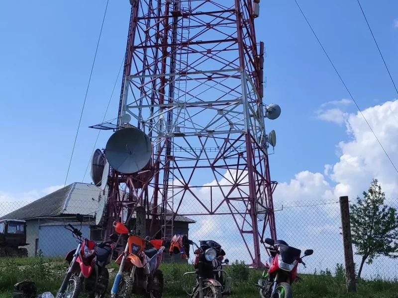
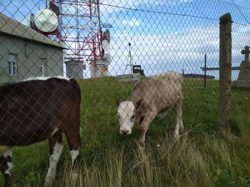
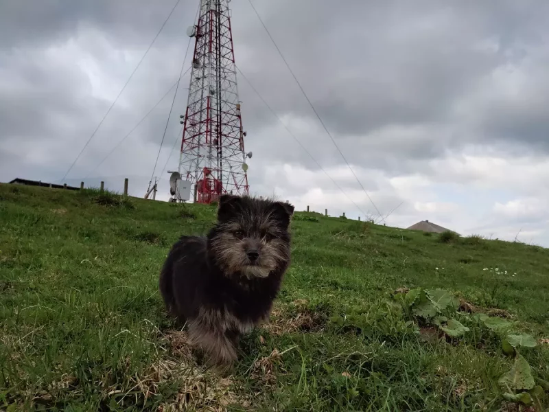
It is not difficult to find the mountain itself, as it has a clear landmark – a relay tower located at the very top.

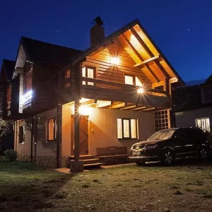
You should start your journey to the top of Rokyta Velyka in the village of Mykulychyn near the road bridge over the Prutets-Chemehivskyi River. From the railway station in Mykulychyn, you should go to the motorway, where, turning left towards Yaremche, you should walk about 200 metres. Then, after the bridge, make a right turn between the Zori Karpat hotel and recreation complex and the shop. From this point, you should walk about 10 km to the top of Rokyta Velyka Mountain. Of these, the first three kilometres should be heading straight east (partly southeast) next to the Prutets-Chemehivskyi River. After about 20 minutes, there will be another fork next to a wooden chapel. Here you should turn right. After a kilometre, there will be a concrete bridge with no handrails. Next to it you can see the remains of an old wooden bridge. The next fork will be in 10 minutes. There is a resting place next to it, and a well on the right. Then tourists have the choice of either going straight along the old paved road that runs along the ravine between the slopes, or turning left and following the road in a serpentine manner to the very top. If you follow the second path, you can see the northern part of Mykulychyn just around the bend. After about one kilometre, both paths to the top converge.

These places are very rich in blackberries and mushrooms. There is a network of various trails among the serpentine, which can greatly shorten the route to the top of the mountain.

The path to the top of Mount Rokyta Velyka runs in the middle of the Bredulets tract. Here you can admire the plantations of relict pine. After walking about 30 minutes from the aforementioned tract, you will get to the open area. To the right of the road, you can see a dilapidated hut, and opposite it, a refreshing spring. Moving up the road to the top, you can admire the forested Mount Kostel to the west, and the relay tower on Mount Rokyta Velyka to the east, with Mount Rokyta Mala and a fragment of the watershed ridge to the right.

If you are lucky enough to climb Rokyta Velyka in clear weather, you can see incredible landscapes of almost half of Hutsul region and even the city of Kolomyia and the regional centre of Ivano-Frankivsk in the distance.

 Walking route

🔰 Start From the hotel “Zori Karpat” in Mykulychyn (71 Hrushevskoho St.)
🚶 Walking distance About 9 km
🕒 Approximate time 4 hours
⬆ Rise From 589 to 1111 m

On the map

What’s interesting nearby?

Other places of interest

Етно-парк «Полонина Перці» в Яблуниці
"Polonyna Pertsi" is the most interesting place for a family rest in Yablunytsya. This incredibly picturesque meadow has become a
Гора Хом’як
Mount Khomyak is located at a distance of almost 6 km from the village of Tatariv and is part of
Музей гуцульського побуту у Татарові
This ethnographic museum is located in the village of Tatariv on the territory of the Koruna recreation complex. The museum's
Музей історії та старожитностей Татарова
To get a deeper insight into the history and traditional way of life in Tatariv, it is worth visiting the
Гора Костел
Among the mountain peaks around Mykulychyn, the first one worth climbing is the majestic Mount Kostel (also known as Horhan
Гора Ягідна
Another mountain peak near the village of Mykulychyn that is definitely worth a visit is the 1,216-metre-high Yahidna Mountain. It
Гора Рокита Велика
While holidaying in the village of Mykulychyn, you should definitely find time to travel to the top of the mighty
Гора Маковиця
If you intend to climb to the top, which was the scene of fierce battles, the best option near Mykulychyn
Чемегівський каньйон
The extremely picturesque Chemehivskyi Canyon has become a very popular natural location in the village of Mykulychyn. Instagram bloggers and
Водоспад Капливець
The Kaplyvets waterfall is located 5 km from the Mykulychyn railway station. It is located on the territory of the
Нарінецький водоспад
The Narinetskyi single-cascade waterfall is 10 metres high. It is located between the villages of Mykulychyn and Tatariv in a
Велика карпатська гойдалка
On the outskirts of Mykulychyn village, you can ride one of the most famous swings in Ukraine. It is located
Броварня “Микуличин”
One of the symbols of Mykulychyn village is the famous Mykulychyn Brewery. It was opened relatively recently - in 2002.
Церква Пресвятої Трійці у Микуличині
In the middle of the nineteenth century, it was decided to build a new wooden church in Mykulychyn not far
Музей етнографії та екології Карпатського краю
At the end of your visit to the museums in Yaremche, you should definitely visit the Museum of Ethnography and
Музей мольфарства у Яремче
Fans of mysticism and magic should definitely visit the Museum of Molfarism in Yaremche. It features ancient household items used
Петропавлівська церква (Музей Шептицького)
While holidaying in Yaremche, tourists will be interested in visiting the modern wooden church of the Holy Apostles Peter and
Екопарк «Ведмежа гора»
Not far from the mini-zoo in Yaremche, there is another interesting location with animals - an eco-park with a petting
Парк-музей «Карпати в мініатюрі»
This unique museum attracts tourists like a magnet. It was initiated in 2015 by the Carpathian National Park and the
Фермерське господарство «Полонина Маковиця»
When you are on holiday in Yaremche, you should definitely visit the cheese dairy of the Polonyna Makovytsia farm to
Гора Синячка
Mount Synyachka, with a height of 1400 metres, is located 20 km from Yaremche. It takes 6 hours to get
Скеля «Слон» у Яремче
At a distance of only 5.5 km from the centre of Yaremche, there is the Elephant Rock, which is formed
Скеля Білий Камінь
The White Stone Rock is located on the outskirts of Yaremche (the northern part of the city is called Dora).
Скелі Довбуша
The rock and cave complex Dovbush's Rocks is located 7.7 km from the central part of Yaremche, Ivano-Frankivsk region, in
Міні-зоопарк «Вольєрне господарство Карпатського національного природного парку»
If you come to Yaremche with children, you should definitely visit the local mini-zoo. It was established in 1992 with
Дорога на гору Говерла
Mount Hoverla is located within two Ukrainian regions - Transcarpathia and Ivano-Frankivsk, and it is 17 kilometers from the border
Легенда гори Близниця
The highest mountain in the Svydovets range of the Carpathians is Mount Blyznytsia, which is 1881 metres high. One of
Природний заповідник Горгани
"Gorgany" is a nature reserve in the Ukrainian Carpathians. It is located in the southwestern part of the Ivano-Frankivsk region,
Женецький Гук
Zhenetskii Huk (Zhenetski Vodospad) is a waterfall in the Ukrainian Carpathians, on the Zhenets stream (a left tributary of the
Музей звичаєвої символіки Гуцульщини
This museum is the most popular in Mykulychyn. Its visit is included in most excursion routes around the village. The
Чорногора
Chornogora is the highest mountain massif of the Ukrainian Carpathians, it includes the town of Hoverla, the highest point in
Озеро Несамовите
Lake Nesamovyte, located on the slope of Mount Turkul, attracts the attention of tourists on the northeastern slopes of the

Tours and excursions

Екстремальний джип-тур “Повний круг”
3 hours
From 4500 ₴
Джипінг в Карпатах
4 hours
From 5500 ₴
Джип тури Карпатами
2 hours
From 2500 ₴
Джип-тур “Стеришора”
3 hours
From 3500 ₴
Джип-тур “Русанівка”
3 hours
From 3000 ₴

Accommodation nearby

Садиба «У Тарнавських» (Микуличин)
10, 1 Travnya St., Mykulychyn
+380 ....
from 2000₴/day
«Микулин Хутірець»
Horba plot, 163A, p. Mykulychyn
+380 ....
from 500 ₴/day
готель «Срібні Роси»
with. Mykulychyn, Laz tract 54
+380 ....
from 1000 ₴/day
Готель «Гірська соната»
Mykulychyn, str. Hrushevsky, 188 B
+380 ....
from 1698 ₴/day

Leisure activities nearby

ресторан при готелі «Міленіум»
St. Hrushevsky, 140 G, c. Mykulychyn
+380 ....
Рес­то­ран «Пивниця»
St. Hrushevsky, 68b, c. Mykulychyn
+380 ....