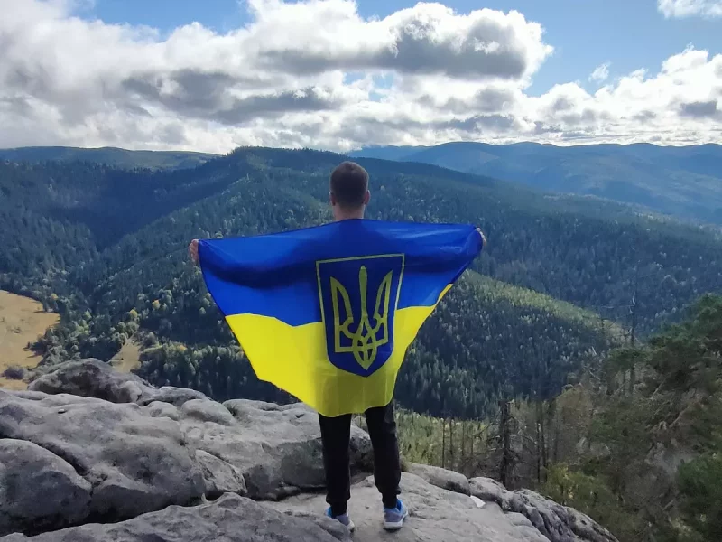
Mount Kostel (Horgan Burachkivskyi)
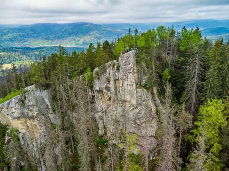
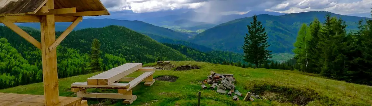
Among the mountain peaks around Mykulychyn, the first one worth climbing is the majestic Mount Kostel (also known as Horhan Burachkivskyi), which is 1049 metres high. This peak is part of the Gorgan system and is located just 4.5 km east of the village of Mykulychyn.
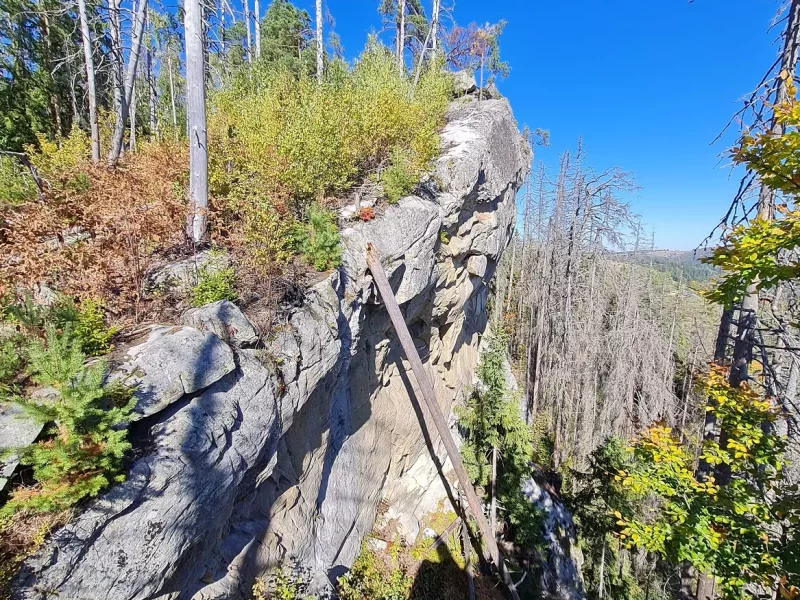
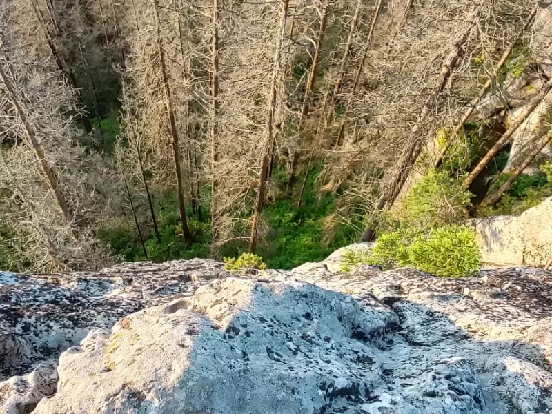
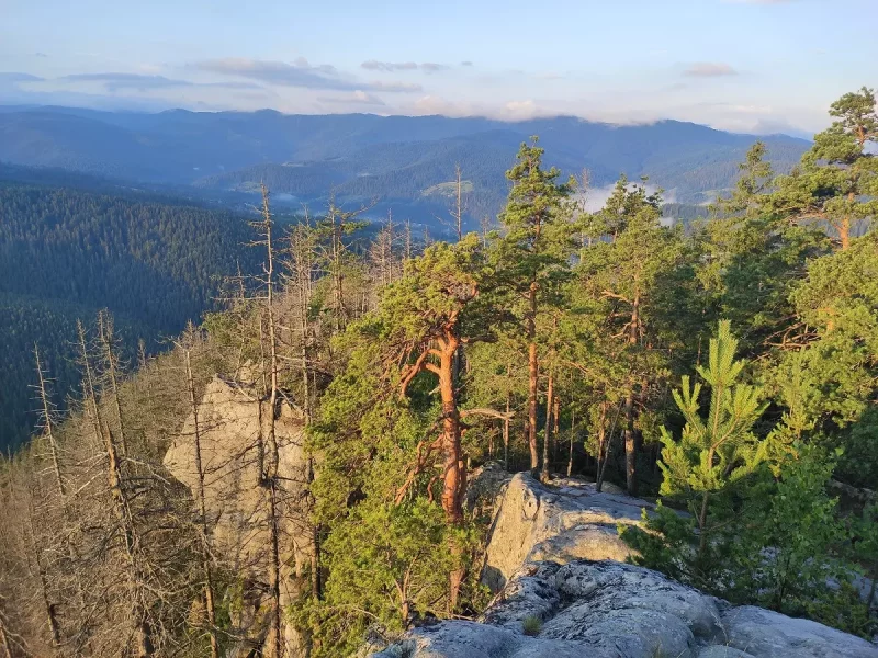
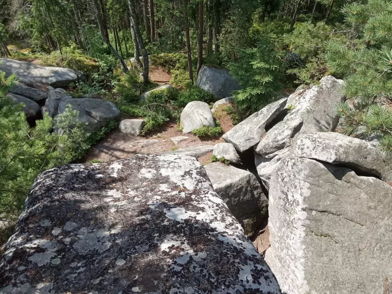
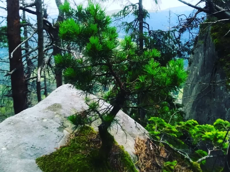
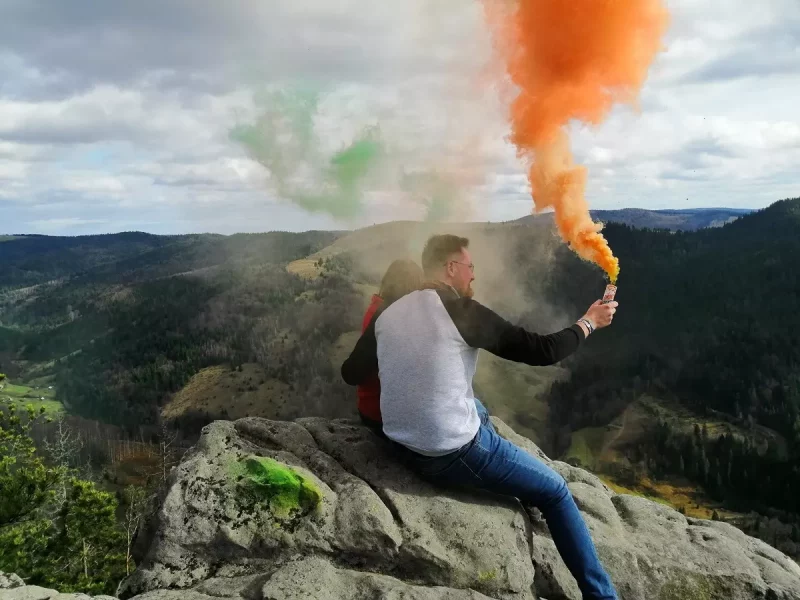
The path to Mount Kostel should start near the road bridge over the Prutets-Chemehivskyi River. Following the canyon of this river through the forest, you can get to the very top. The top of this mountain is a 45-metre-high flat-topped rock. It is a wonderful natural observation deck with incredible views. From here, in good clear weather, you can enjoy the fabulous scenery created by the Horgan, Petros and Hoverla.
Photos and videos of Mount Kostel (Horhan)
| 🗺 Location |
N48°24’10″ E24°39’29″ |
| ⛰ Height |
1049 m |
| 🏔 System of the Ukrainian Carpathians |
Horhany |
| 🧭 Distance from Mykulychyn |
4.5 km |
| 🚙 Road for |
Off-road and on foot |
| 🏕 Stop with a tent |
Yes |
| 🏡 Housing nearby |
Mykulychyn |
| ☕ Cafes and shops |
Mykulychyn |
How do I get to the Kostel (Horhan) rock?
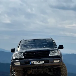
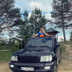
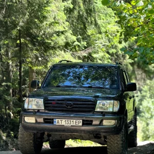
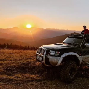
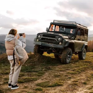
You can climb to the top of Mount Kostel on foot without climbing equipment, or you can take a tour and get as close as possible to the top with an off-road vehicle. From the jeep stop to the summit, you will have to walk 300 metres along the trail. These jeep tours are available for booking at many hotels and manors in Mykulychyn.
If you decide to climb on foot, there are three different routes to the top of Mount Kostel.
On Mount Kostel from the Great Carpathian Swing
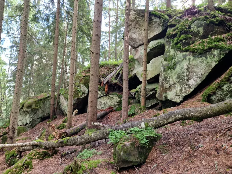
The first of them starts from the Great Carpathian Swing. The way to the mountain from here is along a path near private manors through green thickets and coniferous and deciduous forest. In summer, you can enjoy blueberries along the way, which dot the slopes of this mountain. The closer you get to the top of Mount Kostel, the more often you see huge stone caverns of bizarre shapes and the steeper the ascent becomes. Rumour has it that Oleksa Dovbush used to hold tests of courage and prudence for his Oprishkos recruits in these stone caverns.
| 🔰 Start |
Great Carpathian swing |
| 🚶 Walking distance |
About 3.5 km |
| 🕒 Approximate time |
2 hours |
| ⬆ Rise |
From 686 to 1049 m |
On Horgan Burachkivskyi from Kosmonavtiv street
The second hiking route to Mount Kostel goes along Kosmonavtiv Street next to the Prutets-Chemehivskyi River. After walking for 2.5 km alongside the river, you should cross the water body on a suspension bridge. Then you should move north-west along a winding street with mini-hotels and mansions. The gathering place for tourist groups for this route is a well-equipped and consecrated water source with a sculpture of the Mother of God and gazebos. From there, you should follow the marked path and be guided by the markings on trees and stones.
| 🔰 Start |
Kosmonavtiv Street |
| 🚶 Walking distance |
About 4.5 km |
| 🕒 Approximate time |
3 hours |
| ⬆ Rise |
From 641 to 1049 m |
To Mount Horgan from the holy spring and the sculpture of the Mother of God
The third route to Mount Kostel begins near the spring and the sculpture of the Virgin Mary. It is located to the north of the first route, is longer, but runs not along a path in the middle of the bushes, but along a rocky road with a great opportunity to explore the mountain scenery, breathe the healing mountain air filled with the scents of flowers in the warm season. On the way up the mountain, the road zigzags several times, and then slowly rises to the west along a wide clearing. This path to Mount Kostel is equipped with gazebos where you can rest and route signs every 1-1.5 km. The starting point of the final stage of this route is a tourist parking lot (coordinates 48°24’18 “N 24°39’39 “E), from which you can already see Mount Kostel itself in the south. At this car park, there are signs with the direction and distance to Rokyta Velyka and Kostel mountains. Then you have to walk south-west for only 600 metres to reach Mount Kostel itself.
| 🔰 Start |
Sculpture of the Virgin Mary at the holy spring |
| 🚶 Walking distance |
About 6.5 km |
| 🕒 Approximate time |
4 hours |
| ⬆ Rise |
From 579 to 1049 m |
What’s interesting nearby?

"Polonyna Pertsi" is the most interesting place for a family rest in Yablunytsya. This incredibly picturesque meadow has become a

Mount Khomyak is located at a distance of almost 6 km from the village of Tatariv and is part of

This ethnographic museum is located in the village of Tatariv on the territory of the Koruna recreation complex. The museum's

To get a deeper insight into the history and traditional way of life in Tatariv, it is worth visiting the

Among the mountain peaks around Mykulychyn, the first one worth climbing is the majestic Mount Kostel (also known as Horhan

Another mountain peak near the village of Mykulychyn that is definitely worth a visit is the 1,216-metre-high Yahidna Mountain. It

While holidaying in the village of Mykulychyn, you should definitely find time to travel to the top of the mighty

If you intend to climb to the top, which was the scene of fierce battles, the best option near Mykulychyn

The extremely picturesque Chemehivskyi Canyon has become a very popular natural location in the village of Mykulychyn. Instagram bloggers and

The Kaplyvets waterfall is located 5 km from the Mykulychyn railway station. It is located on the territory of the

The Narinetskyi single-cascade waterfall is 10 metres high. It is located between the villages of Mykulychyn and Tatariv in a

On the outskirts of Mykulychyn village, you can ride one of the most famous swings in Ukraine. It is located

One of the symbols of Mykulychyn village is the famous Mykulychyn Brewery. It was opened relatively recently - in 2002.

In the middle of the nineteenth century, it was decided to build a new wooden church in Mykulychyn not far

At the end of your visit to the museums in Yaremche, you should definitely visit the Museum of Ethnography and

Fans of mysticism and magic should definitely visit the Museum of Molfarism in Yaremche. It features ancient household items used

While holidaying in Yaremche, tourists will be interested in visiting the modern wooden church of the Holy Apostles Peter and

Not far from the mini-zoo in Yaremche, there is another interesting location with animals - an eco-park with a petting

This unique museum attracts tourists like a magnet. It was initiated in 2015 by the Carpathian National Park and the

When you are on holiday in Yaremche, you should definitely visit the cheese dairy of the Polonyna Makovytsia farm to

Mount Synyachka, with a height of 1400 metres, is located 20 km from Yaremche. It takes 6 hours to get

At a distance of only 5.5 km from the centre of Yaremche, there is the Elephant Rock, which is formed

The White Stone Rock is located on the outskirts of Yaremche (the northern part of the city is called Dora).

The rock and cave complex Dovbush's Rocks is located 7.7 km from the central part of Yaremche, Ivano-Frankivsk region, in

If you come to Yaremche with children, you should definitely visit the local mini-zoo. It was established in 1992 with

Mount Hoverla is located within two Ukrainian regions - Transcarpathia and Ivano-Frankivsk, and it is 17 kilometers from the border

The highest mountain in the Svydovets range of the Carpathians is Mount Blyznytsia, which is 1881 metres high. One of

"Gorgany" is a nature reserve in the Ukrainian Carpathians. It is located in the southwestern part of the Ivano-Frankivsk region,

Zhenetskii Huk (Zhenetski Vodospad) is a waterfall in the Ukrainian Carpathians, on the Zhenets stream (a left tributary of the

This museum is the most popular in Mykulychyn. Its visit is included in most excursion routes around the village. The

Chornogora is the highest mountain massif of the Ukrainian Carpathians, it includes the town of Hoverla, the highest point in

Lake Nesamovyte, located on the slope of Mount Turkul, attracts the attention of tourists on the northeastern slopes of the
3 hours
From 4500 ₴.
4 hours
From 5500 ₴
2 hours
From 2500 ₴
3 hours
From 4000 ₴
3 hours
From 3500 ₴
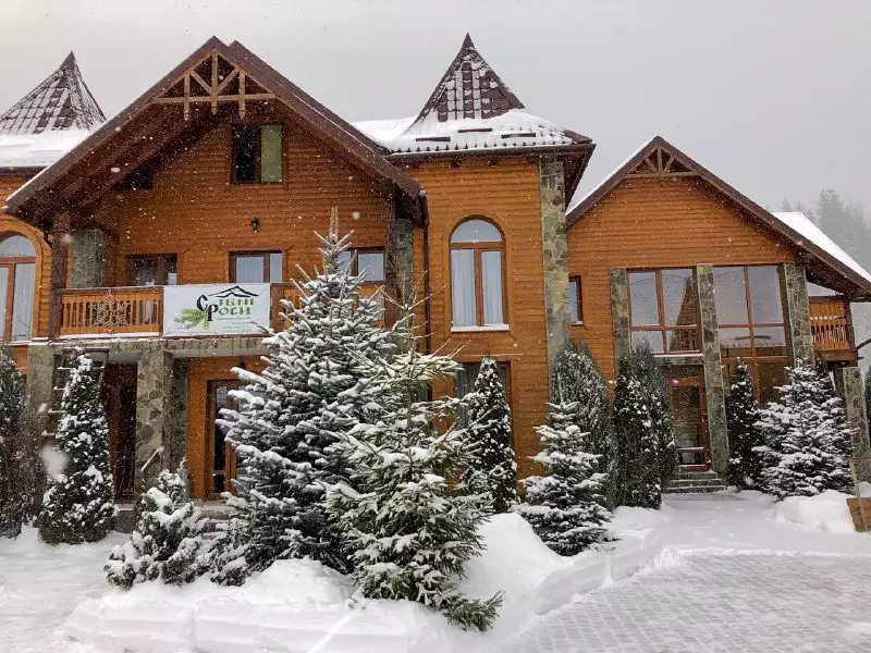
10, 1 Travnya St., Mykulychyn
+380 ....
from 2000₴/day
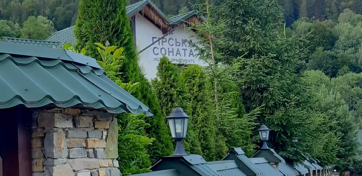
Horba plot, 163A, p. Mykulychyn
+380 ....
from 500 ₴/day
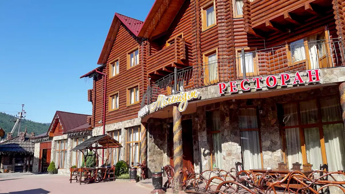
with. Mykulychyn, Laz tract 54
+380 ....
from 1000 ₴/day
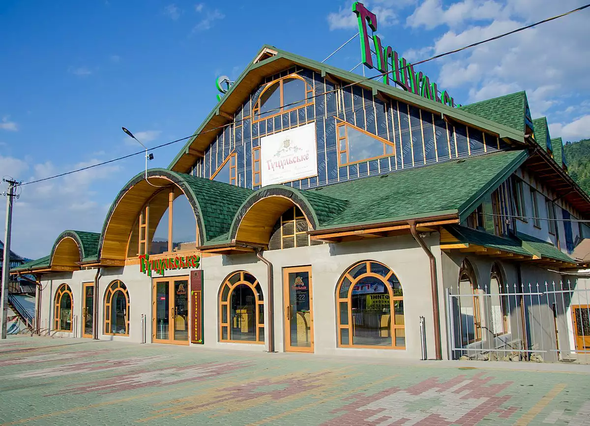
Mykulychyn, str. Hrushevsky, 188 B
+380 ....
from 1698 ₴/day
Leisure activities nearby
St. Hrushevsky, 140 G, c. Mykulychyn
+380 ....
St. Hrushevsky, 68b, c. Mykulychyn
+380 ....