ะ”ะพะดะฐั‚ะธ ะพะฑ'ั”ะบั‚ ะดะพ ะบะฐั‚ะฐะปะพะณัƒ

ะะฐะดัะธะปะฐะนั‚ะต ะฐะบั‚ัƒะฐะปัŒะฝัƒ ั–ะฝั„ะพั€ะผะฐั†ั–ัŽ ั‚ะฐ ะพั‚ั€ะธะผัƒะนั‚ะต ะฑั–ะปัŒัˆะต ั†ั–ะปัŒะพะฒะธั… ะบะปั–ั”ะฝั‚ั–ะฒ. ะœะธ ั€ะพะทะผั–ัั‚ะธะผะพ ะฒะฐัˆ ะพะฑโ€™ั”ะบั‚ ัƒ ะฝะฐัˆะพะผัƒ ะบะฐั‚ะฐะปะพะทั– ั‚ะฐ ะฟะพะบะฐะถะตะผะพ ะฟะพั€ัƒั‡ ั–ะท ะปะพะบะฐั†ั–ัะผะธ, ะฐ ั‚ะฐะบะพะถ ัƒ ะทะฐะณะฐะปัŒะฝะพะผัƒ ะบะฐั‚ะฐะปะพะทั–, ั†ะต ะฑะตะทะบะพัˆั‚ะพะฒะฝะพ!

Lake Brebeneskul

While in the Carpathians, It is not difficult to find picturesque places for a good holiday. But there is a truly amazing and cosy place in these mountains. And it is located in a hollow in the middle between the peaks of Brebeneskul and Gutin Tomnatik.

Can you guess? Yes, this is Lake Brebeneskul. In addition to its beautiful views, it is also famous for being the highest in Ukraine. That is why thousands of tourists visit the picturesque lake at an altitude of almost 2,000 metres every year.

ะžะทะตั€ะพ ะ‘ั€ะตะฑะตะฝะตัะบัƒะป

Photos and videos of Lake Brebeneskul

A brief overview

๐Ÿ—บ Location 48ยฐ06โ€ฒ06โ€ณN 24ยฐ33โ€ฒ44โ€ณE
๐Ÿ’ง Maximum depth 3.2 m
๐ŸŒŠ Area of the reservoir 0.61 ha
๐ŸŒ… Length of coastline 800 meters
โ›ฐ Height 1801 m
โ†• Lake length 147 m
โ†” Lake width 67 meters
๐ŸŒก Maximum water temperature in summer +15 ยฐC
๐Ÿงญ Distance from Rakhiv 35 km
๐Ÿš™ Road for On foot
๐Ÿ• Stop with a tent Yes
๐Ÿก Housing nearby Rakhiv
โ˜• Cafes and shops Rakhiv

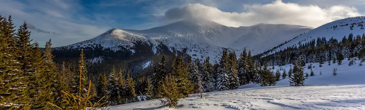
Detailed description of Lake Brebeneskul

The water in the reservoir is very cold, despite its shallow depth, which reaches a maximum of 3.2 metres. The water temperature never exceeds 15 degrees Celsius. First of all, this is due to the lack of sunlight. They cannot physically reach the hollow for most of the day.

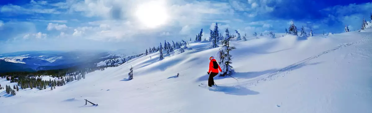
It is because of the cold that it is not very comfortable to pitch tents and stay overnight. Even in May, you can see snow and frost on the shores of the lake. And this is despite the fact that at the same time on the ridge you will be quite warm in light clothes.

If you do decide to spend the night in the hollow, there are a few things to consider:

  • You need to bring warm clothes, because the temperature in the mountains is much lower at night than during the day, and you will be twice as cold near the lake;
  • Do not swim in the lake before spending the night, as it will be very difficult to warm up in the evening;
  • the water in the reservoir is not suitable for drinking, so you should have a certain amount of water with you until the morning.

When you are travelling to these places and decide to go down to the lake, do not forget that after descending, you will need to allow time to climb back up to the ridge. When swimming in the icy water of Brebeneskul, it is not recommended to swim to the depths. Due to the low temperature, even hardened swimmers sometimes get cramped while swimming here. And the depth of 3.2 metres is enough to cause an unpleasant accident. Always remember that mountains do not forgive mistakes.

But despite all the difficulties, such as a difficult climb, cold and remoteness, Lake Brebeneskul is still worth visiting at any time. After all, no photo, even from a very talented photographer, can convey the charm and beauty of these places.

How to get to Lake Brebeneskul?

ย Walking route

๐Ÿ”ฐ Start From the foot of the mountain Hutyn Tomnatyk
๐Ÿšถ Walking distance Hiking through the territory of the reserve

On the map

What’s interesting nearby

Other places of interest

ะกะบะตะปั– ะทะฐะบะพั…ะฐะฝะธั… ัƒ ัะตะปั– ะšะพัั‚ะธะปั–ะฒะบะฐ ะ ะฐั…ั–ะฒััŒะบะพะณะพ ั€ะฐะนะพะฝัƒ
The cliff-rock or Lovers' Rocks above the village of Kostylivka in the Rakhiv district of Transcarpathian region is a Ukrainian
ะกั‚ะฐั€ั– ั„ะพั‚ะพ ะพะฑัะตั€ะฒะฐั‚ะพั€ั–ั— ะฑั–ะปะธะน ัะปะพะฝ
From 1936 to 1938, on the initiative of the Polish government, an astronomical observatory was built on Black Mountain (Pip
ะžะทะตั€ะพ ะ‘ั€ะตะฑะตะฝะตัะบัƒะป
The water in the pond is very cold, despite its shallow depth, which reaches a maximum of 2.8 metres. The
ะ›ะตะณะตะฝะดะฐ ะณะพั€ะธ ะ‘ะปะธะทะฝะธั†ั
The highest mountain in the Svydovets range of the Carpathians is Mount Blyznytsia, which is 1881 metres high. One of
ะฆะตั€ะบะฒะฐ ัะฒัั‚ะพะณะพ ะœะธะบะพะปะฐั ะงัƒะดะพั‚ะฒะพั€ั†ั
One of the largest villages in the Tyachiv district is Nyzhnya Apsha (until 2004, Dibrova). The population of the village
ะ’ะตั€ั…ะฝั ั†ะตั€ะบะฒะฐ ะœะธะบะพะปะธ ะงัƒะดะพั‚ะฒะพั€ั†ั
Two historically valuable wooden churches have been preserved in the Romanian village of Seredne Vodiane (formerly known as Seredne Apsha,
ะฆะตั€ะบะฒะฐ ัะฒัั‚ะพะณะพ ะœะธะบะพะปะฐั
In the Romanian village of Serednie Vodyane (formerly known as Serednie Apsha, population almost six thousand) in the Rakhiv district
ะกะพะฑะพั€ ะ—ั–ัะปะฐะฝะฝั ะกะฒัั‚ะพะณะพ ะ”ัƒั…ะฐ
The temple with a majestic main facade was built on the central square of the city in the period from
ะ ะพะทะฐ ะ’ั–ั‚ั€ั–ะฒ (ะณะพั€ะฐ ะ›ะธัะฐ)
We recommend all visitors to Rakhov to climb Mount Roza Vitryv, from which you can see all the Ukrainian two-thousanders.
ะ ะธะผะพ-ะบะฐั‚ะพะปะธั†ัŒะบะธะน ะบะพัั‚ะตะป ัะฒ. ะฏะฝะฐ ะะตะฟะพะผัƒะบะฐ
One of the oldest buildings in the city is the Roman Catholic Church of St. John Nepomuk. The history of
ะฆะตะฝั‚ั€ ะ„ะฒั€ะพะฟะธ ะฑั–ะปั ะ ะฐั…ะพะฒะฐ
The geographic center of Europe, marked with a geodetic sign, is located between the settlements of Dilove and Kostylivka of
ะœัƒะทะตะน ะตะบะพะปะพะณั–ั— ะณั–ั€ ั‚ะฐ ั–ัั‚ะพั€ั–ั— ะฟั€ะธั€ะพะดะพะบะพั€ะธัั‚ัƒะฒะฐะฝะฝั ะฒ ะฃะบั€ะฐั—ะฝััŒะบะธั… ะšะฐั€ะฟะฐั‚ะฐั…
The territory of the biosphere reserve is located in Rakhiv district. The Museum of Mountain Ecology and History of Nature
ะœัƒะทะตะน ะณัƒั†ัƒะปัŒััŒะบะพั— ะ‘ั€ะธะฝะดะทั–
The Museum of Hutsul Bryndza in the Ukrainian Carpathians is based on a modern interactive approach. The premises of the
ะœัƒะทะตะน ะณัƒั†ัƒะปัŒััŒะบะพั— ั€ั–ะทัŒะฑะธ ะฎั€ั–ั ะŸะฐะฒะปะพะฒะธั‡ะฐ
On November 14, 2014, the Yuriy Pavlovich Hutsul Carving Museum opened for visitors on the first floor of the Hotel
ะงะพั€ะฝะพะณะพั€ะฐ
Chornogora is the highest mountain massif of the Ukrainian Carpathians, it includes the town of Hoverla, the highest point in

Tours and excursions

Accommodation nearby

ะ“ะพั‚ะตะปัŒ ยซRakhiv Hotel & Apartmentsยป
St. Myru, 44, Rakhiv
+380 ....
from 650 โ‚ด/day
ะ“ะพั‚ะตะปัŒ ยซะžะปะตะฝะบะฐยป
St. Myru, 48, Rakhiv
+380 ....
from 480 โ‚ด/day
ะ“ะพั‚ะตะปัŒ ยซะ„ะฒั€ะพะฟะฐยป
St. Myru, 42, Rakhiv
+380 ....
from 400 โ‚ด/day

Leisure activities nearby